http://grid.let.rug.nl/~welling/maps/blaeu.html
If you look carefully at this map, you can see the windmills on the walls of Leiden circa 1652. If you zoom in (JPEG image) to the point at the mid left where the river Rhine (Rijn) exits the city walls and crosses the moat, you can see the bridge and adjacent windmills. This is the site of the Rembrandt family mill that was demolished by the spaniards in the seige of 1574.

the relief of leiden
The city walls and mill had been rebuilt by the time of Rembrandt's birth in 1606 and a mill stands on the site to this day.

This map shows Leiden in 1575 and helps explain the military strategy behind the seige. Click on 'high resolution' and you can zoom in and see how the city walls and windmills looked at the time of seige.
There's a good painting in the Lakenhal that shows the spaniards in siege and the windmills on the city walls.

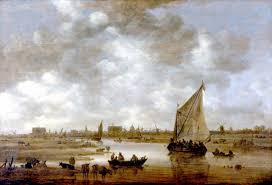
this painting by Goyen also shows the windmills.
Rembrandt in Leiden
The mill today - molen 'de put'.

No comments:
Post a Comment